
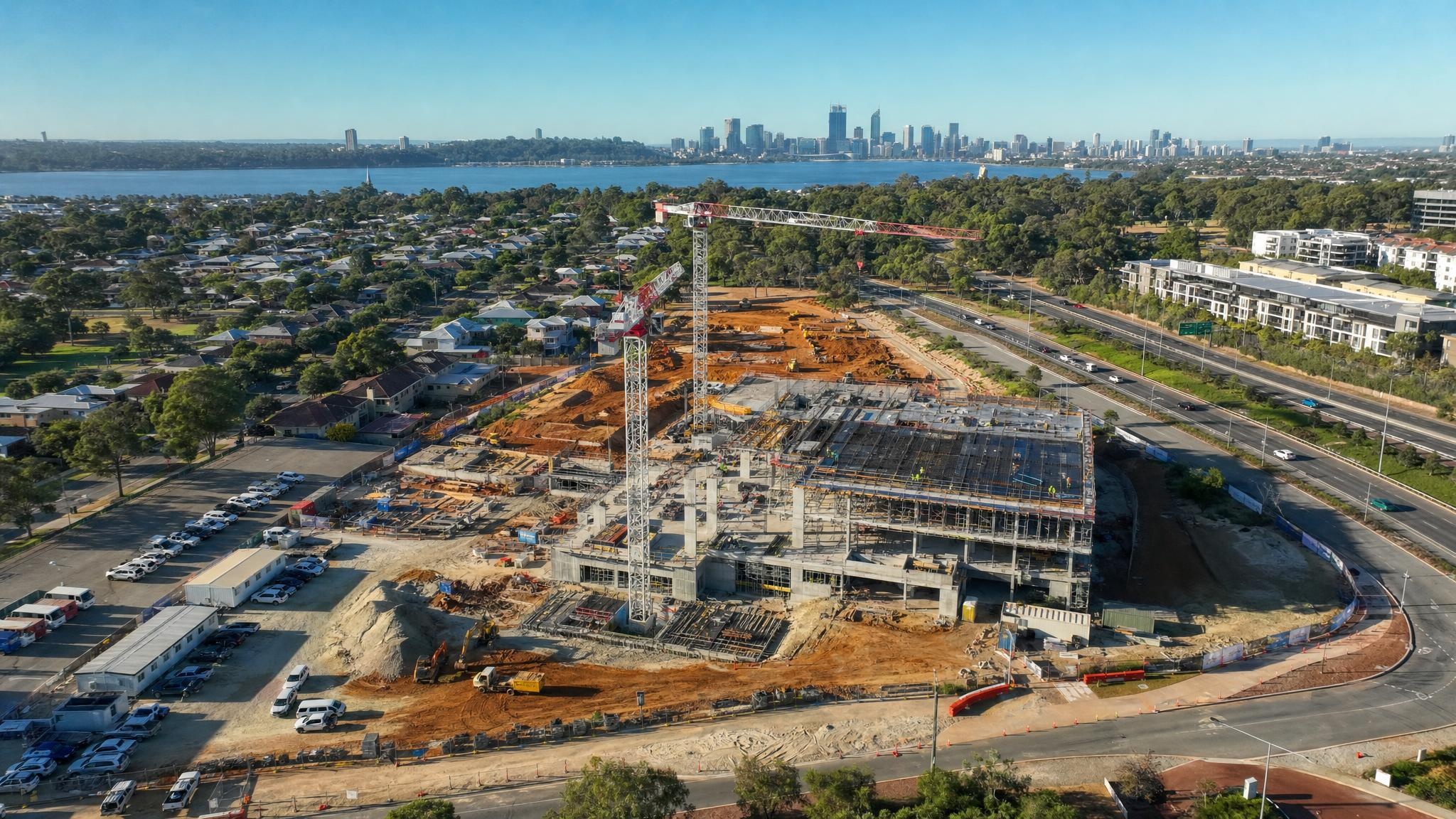
Drone and ground-level construction photography serve complementary purposes. Drones capture aerial scale and site context, while ground-level photography captures close-up craftsmanship and interior detail.
Asking which one is better is a bit like asking whether you need the site plan or the detail drawings.
Most construction projects need both, just at different times and for different reasons.
Drone vs Ground-Level Photography Side by Side
Here’s how the two approaches compare at a glance.
| Feature | Drone Photography | Ground-Level Photography |
| Primary focus | Scope, context and site layout | Detail, interiors and craftsmanship |
| Best use case | Progress tracking, site mapping and external scale | Quality control, trade work and marketing finish |
| Indoor access | Not suitable | Essential and the primary method |
| Cost and speed | Fast coverage of large areas; rates typically range from AUD $750 to $3,000 per day | Slower for wide coverage; may need extra gear |
In short, drones win on accuracy and precision across the whole site. Ground-level photography wins on close-up detail and anything under a roof.
On cost, it’s worth looking past the day rate. A drone can cover in an hour what might take a ground crew most of a day, while ground-level work often needs no extra gear for interiors at all.
The real question is which one gets you the images you need with the least time on site.
Drone Photography: The Big Picture
Drone technology has changed how construction companies see their sites. Here’s where it earns its keep.
What Drone Photography Is Best For
Drone photography is built for scale. It suits large developments, civil works, infrastructure, broad footprints and any project where environmental context matters.
From the air, aerial images show site layout, earthworks, roof progress, access roads and boundary lines. They also show how the site location relates to nearby highways, waterways or neighbourhoods, which ground-level photos simply can’t.
That context is valuable for stakeholder updates, planning approvals and marketing alike.
It’s why professional drone photography services are now a standard part of many builds.
Progress Monitoring and Mapping
Drone progress photography can capture thousands of images or 3D data points in minutes. The result is a repeatable, time-stamped progress record of the entire construction site.
The key is consistency. When a drone flight follows the same flight plan at regular intervals, construction companies can track progress month to month and spot delays early.
With photogrammetry software and data processing, that drone footage becomes orthomosaic maps and 3D models. Project teams can compare them against plans and drawings, often faster than traditional surveys allow. For many projects, the investment pays for itself quickly.
Our guide to drone photography on construction sites goes deeper into how this works in practice.
Improving Safety on Site
Roofs, edges, stockpiles and tall structures can all be captured safely from the air. Nobody needs to climb scaffolding or walk the edge of an open excavation to get the shot.
Improving safety is one of the clearest advantages drones have over traditional methods, and site managers notice it.
Where Drones Fall Short
For most operators, interiors and busy work areas are off limits. Standard CASA rules keep drones away from people, so flying inside a building or over a crew on the tools usually isn’t legal.
Drones are also restricted by airspace and site safety requirements. Drone operations near airports, crowds or live cranes need approvals and careful flight planning.
That’s why you should only hire a drone photographer with a CASA licence and ReOC, and check exactly what they’re approved to do.
birds eye media is one of the few operators in Australia who can legally fly inside, over and around people, thanks to our OONP (Operating Over and Near People) licence. Add our ReOC and $20 million public liability cover, and the paperwork is never the hold-up.
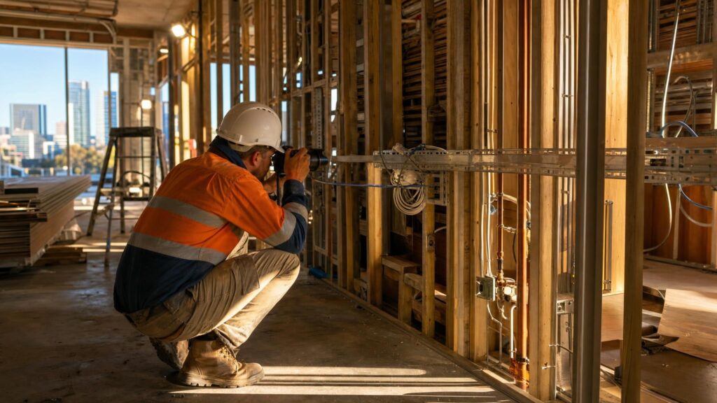
Ground-Level Construction Photography: The Close-Up Story
Traditional photography still does things a drone never will. This is where the detail lives.
What Ground-Level Photography Is Best For
Ground-level photography is best for craftsmanship, interior finishes, structural detail and human-scale progress.
It shows workmanship on materials, electrical and plumbing rough-ins before the walls close up, interior rooms, close-ups under awnings and any area blocked from an overhead view.
It’s also a familiar perspective. Buyers and stakeholders have used ground-level photos to judge build quality and indoor flow for decades, and they trust what they can see at eye level.
Quality Control and Marketing Finish
On site, ground-level photographs support quality control. Think QA records, defect reports, trade sign-offs and handover documentation.
At the end of a complete build, they become the hero marketing images. These are the shots that sell a property to buyers, win awards and fill your clients’ websites.
Strong commercial photography at handover makes a finished project look as good as it is.
Where Ground-Level Photography Falls Short
On large sites, ground-level photography can feel fragmented. It’s hard to understand how individual slabs, walls or roads connect across a massive development.
Covering a wide area from the ground is also time-consuming. Getting a higher vantage point may need extra gear like cranes, EWPs or tracks, which adds cost and complexity.
Why the Best Results Come From Using Both
The most reliable results come from combining the two. Aerial views handle progress monitoring and context, while ground-level photos handle quality and finish.
A simple workflow might look like this:
- A monthly drone flight on a fixed path to monitor progress
- A ground-level walk-through of the same stage to record trade work and site conditions
- A final hero shoot at completion, from the air and on the ground
Together, these create a complete visual record of the project. If a dispute, variation claim or defect question comes up later, you can show exactly what the site looked like from above and up close on a given date.
It also saves money on marketing. The same visits that document progress can produce the drone footage and photos your team needs for social posts, tenders and investor reports.
You can also add videography and time-lapse to the same visits for stakeholder updates. Construction timelapse turns months of work into a short video that clients actually watch.
How to Choose the Right Approach for Your Project
Not every project needs the same mix.
As a rough guide:
- Large footprint, civil or infrastructure work that needs mapping: lead with drone.
- Fit-outs, residential builds, interiors and QA: lead with ground level.
- Marketing a property to buyers: use both.
Also consider site conditions, access, airspace restrictions and budget. To be fair, a small single-dwelling build probably doesn’t need a drone flight every month. A few aerial shots at key stages and a strong ground-level record will do the job.
Whatever mix you choose, ask your provider a few questions upfront. Do they hold a ReOC? Can they fly the same path every visit?
How quickly will you get the images and data back? The answers will tell you a lot about the quality you’ll receive.
Need Further Help Deciding Which to Choose? Reach Out to birds eye media Today!
Still not sure whether your project needs drone, ground-level or a mix of both? That’s an easy conversation to have.
Our team at birds eye media can look at your site, your goals and your budget, then recommend the right approach for each stage of the build.
Get in touch with us today, and we will help you capture your project from every angle that matters.